- Comparison of monocular depth estimation methods using geometrically relevant metrics on the IBims-1 dataset. Computer Vision and Image Understanding (CVIU) 191, 2020, 102877 mehr… Volltext ( DOI )
- Automatic and Semantically-Aware 3D UAV Flight Planning for Image-Based 3D Reconstruction. Remote Sensing 11 (13), 2019 mehr… Volltext ( DOI )
- Monocular-Depth Assisted Semi-Global-Matching. International Annals of the Photogrammetry, Remote Sensing and Spatial Information Sciences (ISPRS) IV-2/W7, 2019, 55-62 mehr… Volltext ( DOI )
- Evaluation of CNN-Based Single-Image Depth Estimation Methods. Proceedings of the European Conference on Computer Vision Workshops (ECCV-WS), Springer International Publishing, 2019, 331-348 mehr… Volltext ( DOI )
- iBims-v1. 2019, (anderer Eintrag) mehr…
- Generation of Ground Truth Datasets for the Analysis of 3D Point Clouds in Urban Scenes Acquired via Different Sensors. International Archives of the Photogrammetry, Remote Sensing and Spatial Information Sciences (ISPRS) XLII-3, 2018, 2009-2015 mehr… Volltext ( DOI )
- The TUM-DLR Multimodal Earth Observation Evaluation Benchmark. 2018, (anderer Eintrag) mehr…
- Automatic UAV Image Geo-Registration by Matching UAV Images to Georeferenced Image Data. Remote Sensing 9 (4), 2017 mehr… Volltext ( DOI )
- A new Paradigm for Matching UAV and Aerial Images. International Annals of the Photogrammetry, Remote Sensing and Spatial Information Sciences (ISPRS) 3, 2016, 83--90 mehr… Volltext ( DOI )
- Automatic Alignment of Indoor and Outdoor Building Models using 3D Line Segments. Proceedings of the IEEE Conference on Computer Vision and Pattern Recognition Workshops, 2016 mehr…
- The TUM-DLR Multimodal Earth Observation Evaluation Benchmark. The IEEE Conference on Computer Vision and Pattern Recognition (CVPR) Workshops, 2016 mehr…
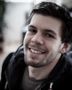
Dr.-Ing. Tobias Koch
Biographie

Tobias Koch wurde 1988 in Erding geboren. Im Januar 2014 erhielt er seinen Master-of-Science-Abschluss in Geodäsie und Geoinformation von der TUM. Seine Masterarbeit wurde in Zusammenarbeit mit der MVTec Software GmbH mit dem Thema: "Tracking mittels des Partikel Filters - Ein merkmalsbasierter Ansatz und dessen Anwendung im Bereich der Verkehrsüberwachung". Seit September 2014 arbeitete er als wissenschaftlicher Mitarbeiter am Lehrstuhl für Methodik der Fernerkundung und ist Teil der Forschungsgruppe Computer Vision, wo er an 3D-Rekonstruktionen im Innen- und Außenbereich aus Bildern forscht, die von Unmanned Aerial Vehicles (UAVs) und Micro Aerial Vehicles (MAVs) aufgenommen wurden.
Seit Abschluss seiner Promotion zum Dr.-Ing, ist er bei der 3D Mapping Solutions GmbH tätig.
Forschung
Forschungsthemen/Schwerpunkte
- Computer Vision
- Luftbild- und Nahbereichsphotogrammetrie
- 3D-Rekonstruktion
- Structure-from-Motion
- Unmanned Aerial Vehicles (UAV), Micro Aerial Vehicles (MAV)
- monokulare Tiefenschätzung
- Navigation und Ansichtenplanung