Spatial and Semantic Modelling of the Environment / Applied Geoinformatics - 1
Please Note: This course is part of three different modules (taught along with other courses) aimed at different study programs. Please identify the applicable module based on your study program.
- Semantic Modelling of the Built World [ED110044] along with the course “Semantic Modelling of Built Facilities”
- Spatial and Semantic Modelling of the Environment [ED110028] along with the course “Building Information Modelling and GIS Interoperability”
- Advance GIS 1 (Applied Geoinformatics - 1) [BGU47025] along with the course “CAFM” (same as the above module)
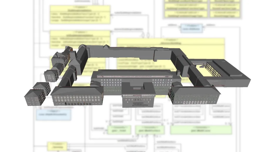
Course Contents
In this course the students learn the methods and technologies for modelling complex geographic information, as they are nowadays used in the EU directive INSPIRE, in the official geo-base data AFIS, ALKIS, ATKIS (AAA) and in semantic 3D city models (CityGML). Besides explaining the fundamental modelling concepts, the model-driven derivation of storage structures and data transfer formats is discussed in particular. The exercises range from simple understanding of modern data models to the development of complex data models by the students themselves and the manual and automatic derivation of appropriate transfer formats for various fields of application.
- Information Modeling
- Advanced UML diagrams - Structures and models for complex geo data
- GIS standards for geographic information
- ISO 19107: Spatial Schema
- ISO 19109: Rules for Application Schema - Information models for the built environment
- CityGML: application schema for GML
- INSPIRE data modelling and encoding - Storage and exchange of geo data
- Model Driven Architecture (MDA): from data models to transfer formats via the model-driven approach
- eXtensible Markup Language (XML) as generic storage and transfer format
- XML Schema Definition Language (XSD) as schema language for XML files
- Geography Markup Language (GML) and the development of GML application schemas as storage and transfer format for geodata
Pre-requisites
Fundamentals in Geoinformatics as covered by the modules
- “Geospatial Information Science” of the Master program ITBE
- "Spatial Data Management and Visualisation" of the Master program Geodesy and Geoinformation
- "Geoinformatics" of the Bachelor program Geodesy and Geoinformation.
Learning Outcomes
At the end of the module students are able to:
- understand and apply methods and technologies for modelling complex geographic information and for deriving storage structures and data transfer formats via the model-driven approach, to create complex geo data models and to derive manually and automatically appropriate transfer formats for various fields of application. Furthermore, the students can apply the relevant ISO standards for modelling geodata and the international standards GML and CityGML.
- understand methods and technologies from Building Information Modeling (BIM).
- analyze the application possibilities resulting from coupling BIM and GIS methods.
Contact
For any queries regarding this course - lecture and exercise content, course dates, exam information, etc. please reach out to the following staff members.