Foundations of Spatial Data Infrastructures
Course Contents
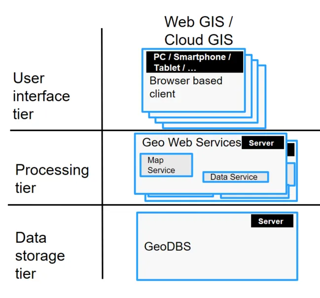
The course is part of the module Geoinformatics for Land Management and provides insights into methods and technologies for Spatial Data Infrastructures (SDI) such as Geodatabase Systems and Geo Web Services.
The topics covered by this course are:
- Geospatial Database Systems,
- Principles of the Geo Web Services approach and the underlying technologies such as XML, XML-Schema and HTTP,
- International standards for Geo Web Service Interfaces and related standards such as WMS, WFS, GML, SLD,
- Application of Geo Web Services in Spatial Data Infrastructures (SDI) in general and Land Information Infrastructures in particular.
Students will be familiarised though working with practical examples with conceptual and practical aspects of Spatial Data Infrastructures.
The module is completed with a learning portfolio as a module exam. The course is related to one out of three components of the learning portfolio accounting for 50% of the final grade. In this component the students have to set up a Geospatial Web application, which is created during contact hours, using their previously acquired abilities in the fields of Geoinformatics and Cartography.
Contact
For any queries regarding this course - lecture and exercise content, course dates, exam information, etc. please reach out to the following staff members.