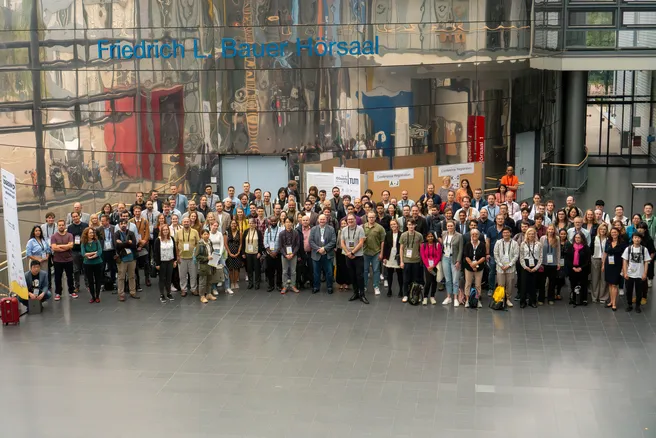
The 18th edition of the 3DGeoInfo International Conference was hosted in Munich, at TUM Garching by the Chair of Geoinformatics on 13th and 14th September 2023. Chaired by Prof. Dr. Thomas H. Kolbe and ably supported by the staff members of the chair, the event saw a global participation from Japan to the US. The discussion in conference was focused on the various concepts of 3D City modelling and Urban Analysis from 3D/4D Modelling, data acquisition to GIS-BIM Interoperability and today’s Smart Cities. 51 papers (full papers + extended abstracts) were selected, published and presented after a rigorous review by a panel of eminent researchers in the field.
The keynote on the first day was given by Mr. Yuya Uchiyama, Director for IT Strategy and Coordination and the PLATEAU project, MLIT, Japan titled “Project PLATEAU - The Initiative of Digital Twin in Japan”. On the second day, the keynote was delivered by Dr. Filip Biljecki from the National University of Singapore titled “Research Insights and Perspectives of Urban Digital Twins”.
The conference dinner was hosted at the historic ‘Augustiner Stammhaus’ in the heart of Munich giving all the participants a taste of the traditions of Bavaria. The awards for the Best Paper and the Runners-up were also presented at the dinner. The Best Paper was awarded to “Humans as Sensors in Urban Digital Twins” by Binyu Lei and team from the National University of Singapore and the Runners-up to “Investigation of CityGML 3.0 for modelling temporal aspects in underground land administration” by Bahram Saeidian and team from the University of Melbourne.
Further, some of our own staff members presented their research on various topics relevant in the discussion. Christof Beil presented his research on ‘Automatically evaluating the service quality of bicycle paths based on semantic 3D city models’, Son H. Nguyen presented ‘Identification and Interpretation of Change Patterns in Semantic 3D City Models.’, Dr. Ihab Hijazi and Hamza Zahid presented ‘Enhancing Realism in Urban Simulations: A Mapping Framework for the German National Standard XPlanung and CityGML.’, Joseph Gitahi presented ‘Visualisation Requirements for Integrated 3D City Models and Sensor Data in Urban Digital Twins’ and Medhini Heeramaglore took part in the presentation ‘Artificial Intelligence for the automated creation of multi-scale digital twins of the built world - AI4TWINNING’.
The event was lauded as a success and more information along with photographs of the event can be found on the conference website.
