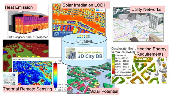
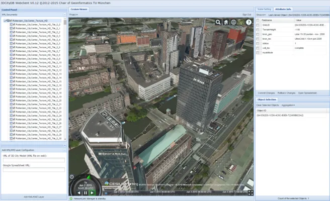
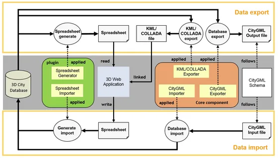
Virtual 3D city models are complex mappings and inventories of the urban environment, which are being used in many different research and application fields like Smart Cities, urban planning, environmental and training simulations, disaster management, and energy assessment. The 3D City Database (3DCityDB) is an Open Source geodatabase schema and set of tools for managing and visualization of large 3D city models. It plays an important role in many research projects of the Chair of Geoinformatics. Above, it is employed in productive environments in many cities worldwide like Munich, Berlin, Zurich, Rotterdam, Helsinki, Singapore, London etc. Interfaces to different commercial 3D GIS software systems exist. The included tools provide full support of the OGC standard CityGML and allow for KML / COLLADA / glTF exports in order to create 3D visualizations for Digital Virtual Globes like the Cesium WebGL Digital Globe, Google Earth, and ArcGIS. By using the spreadsheet generator plugin the thematic data of CityGML objects in the geodatabase can also be extracted and mapped to simple tables.
The development of 3DCityDB was initiated and has been lead by Prof. Dr. Thomas H. Kolbe from the beginning. It started in 2003 at the Institute for Cartography and Geoinformation (IKG) of the University of Bonn and was continued from 2006 at the Institute for Geodesy and Geoinformation Science (IGG) of Berlin University of Technology. Since 2012 the 3DCityDB and its tools are further developed by the Chair of Geoinformatics of TU Munich (TUMGI) in collaboration with the companies virtualcitySYSTEMS GmbH and M.O.S.S. Computer Grafik Systeme GmbH on the basis of a cooperation agreement. This agreement ensures that not only the involved parties but also the international user community benefit from all improvements and new features. With the release of 3DCityDB version 3.3 the Open Source license was switched from LGPL3 to Apache 2.0 simplifying the inclusion and adoption of 3DCityDB in third party products. Aim of the free provision of the 3DCityDB is last but not least the advancement of the adoption of the CityGML standard, which is an essential research topic at the Chair of Geoinformatics.
We use 3DCityDB also in teaching and student projects. Students learn about 3D city modeling, about mapping of complex object oriented data models to spatio-relational database schemas, spatial databases in general, and 3D geovisualization. These aspects are addressed and explained in detail in the extensive and complete documentation coming with the 3DCityDB. The documentation as well as a number of online courses can be found on the 3DCityDB homepage.
