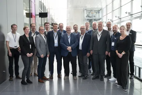
The project aims to advance the digital transformation in the construction sector in Germany by digitizing and simplifying processes for “building and living” through open BIM, uniform interfaces and standards. The aim is to convert the current 2D drawing-oriented site plan into a three-dimensional, model-based and BIM-capable plan that integrates both the building and information about the surroundings. By using standards such as IFC and CityGML, process chains between BIM and GIS domains are to be made more efficient. This should therefore accelerate the approval processes and automate checks, such as for clearance areas.

Project Description
Increasingly complex building regulations, scarce building land and the densification of buildings are making it more and more difficult to submit building applications.
The 2D site plan serves as an essential part of the planning application documents, which demonstrates the integration of the building project into its surroundings in terms of building regulations and planning law. However, the growing amount of information makes it more difficult to read the 2D site plan, which is still based on drawings. In addition, the planning process with the Building Information Modeling (BIM) method is based on completely new procedural and information technology principles. BIM is object-oriented and geometrically 3D from the very beginning, so it makes sense to put the site plan on a 3D basis as well.
Due to the many parties involved in the planning process, including publicly appointed surveyors (ÖbVI), design authors (architects) and approval authorities, a standardized data structure must be created as the basis for efficient data exchange. This is particularly relevant for accelerating review processes by means of automatized routines during planning or approval.
A quality-assured 3D basis created with geodetic expertise is currently not available to the parties involved in a standardized data structure, which results in a significant gap in the process of a digital building application. Existing projects on the digital building application process do not address the topic of 3D site plans in sufficient detail.
The project will close this gap and develop and test a prototype for a standardized 3D site plan based on existing standards. The need for research arises from the fact that the site plan represents the embedding of the new construction in the environment, i.e. data from the BIM and GIS domains must be efficiently integrated and utilized. The 3D site plan should become an integral part of the BIM-based building application process and ideally fit into the preliminary work of the ZukunftBau project “BIM-based building application” ("BIM-basierter Bauantrag").
To realize this, the project builds on preliminary work such as
- Zukunft Bau-Projekt „BIM-basierter Bauantrag“
- Deutsches Institut für Bautechnik (DiBT)-Projekt „Digitalisierung der Musterbauordnung“ (MBO2BIM)
- Master's thesis „Entwicklung einer CityGML Application Domain Extension: Der Amtliche Lageplan in 3D“ (Müller, 2021) at TUM
- Master's thesis „BIM-gerechter 3D-Lageplan zum Baugesuch“ (Jansen, 2021) at RWTH Aachen
- Standards XPlanung, XBau through integration of the XLeitstelle
- Standards CityGML, IFC etc.
Expected results
The project is developing an information model that integrates the GIS and BIM domains and creates automated inspection processes and process chains between these domains. These processes are described using standardized modelling tools (UML and BPMN) and are prototypically implemented in existing software environments. In addition, the data model is mapped to GIS and BIM. CityGML is used for the GIS representation and IFC for the BIM representation. This will enable the official 3D site plan to be used directly in GIS and BIM systems. The interfaces and software prototypes should be freely available to enable market-ready software developments. Finally, it will be shown how automatic checks (including clearance areas) can be realized on the basis of the 3D site plan.
Project Period
2024 - 2026
September 24, 2024 - Kick-off at the INTERGEO conference, duration: 24 months
Project Sponsor
- This project is funded by the Federal Institute for Research on Building, Urban Affairs and Spatial Development (Bundesinstitut für Bau-, Stadt- und Raumforschung) on behalf of the Federal Ministry of Housing, Urban Development and Building (Bundesministeriums für Wohnen, Stadtentwicklung und Bauwesen) with funds from the Zukunft Bau research funding program (Zukunft Bau Forschungsförderung).
Project Partners
The project is being carried out in a project consortium coordinated by the German Association of Publicly Appointed Surveyors (BDVI).
Research institutions:
- Technische Universität München (TUM), Chair of Geoinformatics
- RWTH Aachen University, Chair of Computing in Civil Engineering and Geoinformation Systems and Geodetic Institute (RWTH, gia)
Further project partners:
- Software company HHK Datentechnik (HHK)
- KDS Semler Schult, publicly appointed surveyors
- Leitstelle XPlanung / XBau (XLST)
- Molestina Architekten + Stadtplaner GmbH
- Building management of the City of Cologne (Köln)